Trail Cycle La Canourgue - La Lozérienne édition 2009 - 47 km - Photo

La Lozérienne édition 2009 - 47 km

 tracegps
tracegps

User

© OpenStreetMap contributors
Length
Length
47 km
Max alt
Max alt
1111 m
Uphill gradient
Uphill gradient
950 m
Km-Effort
Km-Effort  
59 km
Min alt
Min alt
512 m
Downhill gradient
Downhill gradient
949 m
Boucle
Boucle
Yes
Creation date :
2014-12-10 00:00:00.0
Updated on :
2014-12-10 00:00:00.0

(0 Reviews)

Cycle
Cycle
2h30
Difficulty : Difficult

Scan this QR Code to open this trail in the SityTrail application

FREE GPS app for hiking

Logo SityTrail SityTrail

IGN / Geographical institutes

Download SityTrail from the App Store Download SityTrail from Google Play

Logo SityTrail SityTrail World

The world is yours!

Download SityTrail from the App Store Download SityTrail from Google Play Download SityTrail on Huawei AppGallery

About

Trail Cycle of 47 km to be discovered at Occitania, Lozère, La Canourgue. This trail is proposed by tracegps.

Description

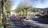
Les 09 et 10 Mai 2009 Après 4 éditions à vif succès, LVO (Ludovic Valentin Organisation) compte faire franchir un cap à l’évènement pour marquer cette cinquième édition anniversaire. En 2009, l’épreuve sera toujours inscrite au calendrier du challenge national « Cyclo’tour » et y figurera comme la deuxième manche, après l’ouverture de saison faite dans le Vaucluse. En basant l’évènement à La Canourgue le 10 mai prochain, l’accueil des coureurs sera à son meilleur niveau : un site accessible, bien desservi, de taille importante et adapté à l’évènement. Les nouveautés pour 2009 : En plus de proposer une cyclosportive le dimanche, nous mettons en place une randonnée sur 2 jours proposant ainsi à public différent de profiter lui aussi des routes et sites lozériens remarquables. Organisée sur 2 jours, cette randonnée permettra d’accueillir des participants pour une durée plus importante, transformant La Lozérienne en un véritable week-end touristique en même temps qu’une compétition cyclosportive de masse. De plus, l’implication et la collaboration déjà importante avec les associations locales (comité des Fêtes de Banassac), seront renforcées par l’arrivée du côté de l’organisation du club « les Cyclos du Malpas » tout comme d’autres associations locales.

Elevation profile

Photos

Positioning

Country:
France
Region :
Occitania
Department/Province :
Lozère
Municipality :
La Canourgue
Location:
La Canourgue
Start:(UTM)
517047 ; 4920028 (31T) N.

Trails nearby

Trail Nordic walking Banassac-Canilhac - 48 La Canourgue Banassac Les grès rouges - Photo
Nordic walking
Maryma

Nordic walking

Easy
(1)
Banassac-Canilhac, Occitania, Lozère, France
12.5 km | 17.7 km-effort
2h 30min
Yes
Trail Walking La Canourgue - la canourgue les vignes - Photo
Walking
RoMo

Walking

Difficult
La Canourgue, Occitania, Lozère, France
25 km | 37 km-effort
7h 37min
No
Trail Walking La Canourgue - Dessus la canourgue - Photo
Walking
peillo

Walking

Difficult
La Canourgue, Occitania, Lozère, France
9.1 km | 14.4 km-effort
3h 48min
No
Trail Walking La Canourgue - Au-dessus de La Canourgue - Photo
Walking
vertygo

Walking

Medium
La Canourgue, Occitania, Lozère, France
12.7 km | 18.5 km-effort
3h 9min
Yes
Trail Walking Saint-Saturnin - Vers l'antenne de La Canourgue - Photo
Walking
Alain-49

Walking

Easy
Saint-Saturnin, Occitania, Lozère, France
6.9 km | 8.8 km-effort
1h 42min
Yes
Trail Walking Banassac-Canilhac - GR60 jour 7 - Photo
Walking
werth

Walking

Difficult
Banassac-Canilhac, Occitania, Lozère, France
22 km | 29 km-effort
9h 43min
No
Trail Other activity La Canourgue - Atlamed - La Canourgue - Les Vignes - Photo
Other activity
jbtregouet

Other activity

Very easy
La Canourgue, Occitania, Lozère, France
27 km | 38 km-effort
6h 30min
No
Trail Other activity La Canourgue - le chemin des falaises  - Photo
Other activity
Lecoester

Other activity

Easy
La Canourgue, Occitania, Lozère, France
12.1 km | 16.4 km-effort
2h 55min
Yes
Trail Cycle La Canourgue - La Lozérienne édition 2009 - 84 km - Photo
Cycle
tracegps

Cycle

Difficult
La Canourgue, Occitania, Lozère, France
86 km | 113 km-effort
3h 30min
Yes


Close
My subscriptions